• Biblical Families is not a dating website. It is a forum to discuss issues relating to marriage and the Bible, and to offer guidance and support, not to find a wife. Click here for more information.

Some Einstein sh..tuff, science discussion

Good spotting, however it means most likely that whoever wrote that article made a typo. They're quoted from a previous source, and probably just misquoted - it's easy to quote the same number twice. It's obvious the volume of water would always be larger than the volume of sediment. There's no point doing any maths on numbers that were simply a mistake.

Nope. Daniel's quoted source cited the stated and combined volume of the two supposed lakes.


1739813358747.png

Various sources cite the volume of the Grand Canyon as being 5,450,000,000,000 cubic yards which works out to about 1,000 cubic miles. Not three thousand yet the 3,000 cubic mile figure is cited repeatedly across the numerous sites that promote the hydroplate theory. Somehow this figure is important to the people promoting the theory even though it is utterly implausible.

It is still laughably implausible that only three units of water can completely scour and decompose one unit of solid rock.

It is further laughably implausible that these two imagined lakes could overcome and breach a physical barrier that is 120 to 277 miles thick.

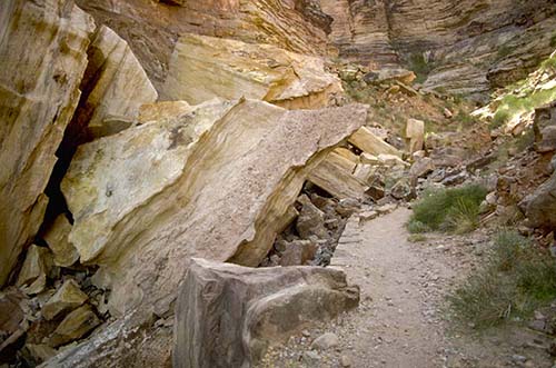
What is missing from the physical evidence to support this theory that a catastrophic flood created the Grand Canyon are the physical traces commonly found in areas subjected to catastrophic flooding.

1. Erratics. These are the large boulders that are swept far downstream by massive floods. These erratics can be traced back to their approximate origins. No such erratics have ever been found downstream of the Grand Canyon. The size of erratics that are not borne by ice (as is seen in the Willamette Valley) is sometimes used to calculate the volume and force of the water needed to perform this act.

2. Scablands. There are no scablands downstream of the Grand Canyon as there are downstream of Lake Bonneville and Lake Missoula. Areas where sediments and soils were completely washed away by catastrophic floods.

3. Massive cataracts. These are places that demonstrate massive amounts of erosion such as is found in the Pacific Northwest. Massive amounts of water scoured out waterfalls shaped similarly to the waterfalls at Niagara, leaving behind significant evidence of their existence. There are no such cataracts either in or downstream of the Grand Canyon and proof of this is the fact that people raft the river every year without needing to portage around such cataracts.

There is more but these three things are sufficient to make the case that there was no evidence of catastrophic flooding downstream from the Grand Canyon on a greater scale than what is seen in the Columbia River Valley.

In modern times we can see the power of water and its limitations in catastrophic flooding events like dam failures:


In every one of these failures you can still find evidence of their occurrence. Erratics in the form of large parts of the dams can still be found downstream, gravel and sediment deposits can still be found downstream that occur well away from the normal riverbeds.

But most notably the thing that is eminently observable as being absent is a drastic scouring of the land downstream. Even with a massive amount of water released there were still homes and other structures that survived the floods, roads survived, railroads survived, recognizable landmarks survived, and for the most part river channels were relatively unaffected as can be verified by comparing pre-flood maps with post-flood maps.

The absence of catastrophic flood evidence at the Grand Canyon (cataracts, scablands, erratics, etc.) indicates a gradual erosion of the canyon over time.

Wishing it to be otherwise does not make it so.
 
So, it was the sediment volume Daniel's source misquoted. As I said, one number was a typo.

Slow down a bit Megan, you rush like a bull into doing maths with numbers without taking the time to even consider whether they are the ones claimed. So you end up completely accidentally making an elaborate straw-man argument. And you're still not using the right numbers.

So, the total volume of the canyon is 1000 cubic miles, not 3000. But the theory as I understand it has always been that the dam breach didn't scour out the entire canyon, rather made the initial scour in the landscape, which then became a river. Top part taken by rapid floodwaters, lower part by slow erosion by the river, and people tend to point to different erosion patterns in the upper layers vs the lower layers to show the difference. Which would mean nobody is claiming that dam breach scoured out even 1000 cubic miles of sediment.

The question is how much sediment is claimed to be shifted by that dam breach vs how much by the river later. I propose letting Daniel figure that out and come back with the proper numbers for you. You've made a good case that the numbers he's presented so far are incorrect.
 
You're not really thinking this through, are you? Because that dam of yours has to be over 120 miles thick.
My apologies. Not the Kaibab plateau. That came about as a result of hydrolic forces, when weight was shifted due to the water drainage. The Colorado plateau was the one with the uplift that formed the dam that was breached
No. All lakes have shorelines or high water marks. Period. Or else there was no lake.
You really weren't paying attention. The link I posted posits the following reasons why the lake would not have ahad a shoreline:

- Missoula and Lake Bonneville, for example, existed for two or more centuries longer than Hopi and Grand Lakes so they had much more time to leave behind evidence of their longstanding waters.
- Missoula and Bonneville and other ancient lakes were situated in geologically stable areas and had more consistent water levels to etch clearer shorelines.
- Grand and Hopi Lakes were subject to the uneven hydraulic lifting of the rising Colorado Plateau. As a result, their water levels were frequently changing.
- Grand and Hopi Lakes, as endorheic (or closed or terminal) basins with no outlets, may have been in a state of filling throughout most of their existence so that a continually rising water level wouldn't leave a strong shoreline.
- The lakebeds for Grand and Hopi were actually tilting, which dramatically shifted changing their shorelines, even when there would otherwise not have been a change in their volumes of water. Just as Yellowstone Lake is tilting today, tilting Grand Lake even just a tenth of a degree would move its shoreline by a few miles and far more than that if the axis of the tilt was far from the lake's center.)
- These two basins forming atop the unstable and rising Colorado plateau would have been rapidly filling throughout their approximately 250-year long histories by heavy post-flood precipitation tending to constantly increase their water levels.
- Less than three centuries after the flood, the sediments below and around the lakes would still be wet and only partially cemented and so, far more vulnerable to typical erosion.
- The exceedingly high energy of the catastrophic draining of these massive great lakes scoured their basins removing much of the lakebed sediments.
- The high water table after the flood resulted in powerful springs erupting from the floor and walls of the basins further eroding away lakebed sediments that would otherwise have been left behind.

Nope. It's not my theory and I don't need to attack it or defend it. The people who hold this theory need to make sense and it's their job to make their case. And they have not which is why this is only discussed in a non-standard manner on relative fringe sites and by people who've never used a garden hose to wash down anything.
Ha! You really weren't paying attention to the credentials of Bryan Nickle.

We're discussing the removal of THREE THOUSAND CUBIC MILES OF ROCK AND SEDIMENT by a river. Unless you think aliens carted it away to their home planet then it had to be deposited in an alluvial plain or other alluvial deposit. If you read back in this topic you'd see I've already addressed this. The Imperial Valley of California is the alluvial fan for the Colorado River. Case solved.
There was more water than what was contained in those lakes, and if you had been paying attention especially to that last point, you would have seen that this objection has been answered. Most of the sediments referred to as having been removed, were soft, post flood sediments. I'm not sure how that escaped your attention. Missoula was much smaller, and yet there are numerous boulders that it released, in it's flow. Hopi Lake had 250 feet elevation, so it was like a Niagara Falls release of energy when that dam burst.

Daniel's post says that 3,000 cubic miles of water scoured and removed 3,000 cubic miles of rock that weighs 2.5 to 3 times as much as the water does. Nonsense. And I'm being polite by not saying bulls#it. You're welcome. ;)

Here's an experiment for both of you and I am going to give you both an unfair advantage here:

1. Take a marble and put it on a flat surface. Like glass. Very low friction, right?
2. Then take an amount of water in equal volume to the marble and then find a way to move the marble with the water by pouring it. You can't use an artificial instrument like a syringe to amplify the force. But you can use a slope, a hollow tube, or anything else that does not use human energy to amplify the force of the water.
Can I drop the water from an elevation of 250 ft above the marble?

How far did you move the marble? Not far. Even with the unfair advantage of a glass marble on a glass surface an equal volume of water is all but useless in moving the marble.

Now take a rock. Use your garden hose to move it. How much water must you use to move even a small rock a short distance? Was it a lot more than a volume of water equal to the volume of your rock? Of course it was.

Put a grain of sand in your kitchen sink. How much water must you use to wash that grain of sand down the sink? Even a single drop of water will be easily a hundred times the volume of the grain of sand yet that won't be enough.

But I'm supposed to just blithely accept that a volume of water blasted its way through an equal volume of solid rock?
Nope! You would have additional water that was embedded in the soil that rushed out.

I believe it. I won't insult his intelligence for coming up with other fanciful explanations that, let's just say, they don't hold water.
 
So, it was the sediment volume Daniel's source misquoted. As I said, one number was a typo.

Slow down a bit Megan, you rush like a bull into doing maths with numbers without taking the time to even consider whether they are the ones claimed. So you end up completely accidentally making an elaborate straw-man argument. And you're still not using the right numbers.

So, the total volume of the canyon is 1000 cubic miles, not 3000. But the theory as I understand it has always been that the dam breach didn't scour out the entire canyon, rather made the initial scour in the landscape, which then became a river. Top part taken by rapid floodwaters, lower part by slow erosion by the river, and people tend to point to different erosion patterns in the upper layers vs the lower layers to show the difference. Which would mean nobody is claiming that dam breach scoured out even 1000 cubic miles of sediment.

The question is how much sediment is claimed to be shifted by that dam breach vs how much by the river later. I propose letting Daniel figure that out and come back with the proper numbers for you. You've made a good case that the numbers he's presented so far are incorrect.
The theory also holds that there was some uplift, due to hydraulic lift from underlying magma in subterranean chambers. Some of the rock as the weight was removed, was comprised of limestone which buckled upward and cracked, creating deep channels for the water to pour through. Bryan Nickle's video explains a lot of this.
 
For those interested, a lot of research has been carried out following the Mount Saint Helen's eruption, which occurred in May 1980. It is a well studied volcanic event which has yielded significant insights into canyon creation and river formation, and has caused many old-earth geologists to rethink their suppositions regarding the formation of Grand Canyon. There are excellent articles available regarding the eruption on websites such as the Institute for Creation Research (icr.com), and Answers in Genesis. Shalom
 
Rocks were not always rock. The recent example(1980) of the lahar around Mt St Helens in Washington state revealed incredible layers of sedimentary rock cut away by water flow. Problem: The layered rocks were not there prior to the flow. They were deposits quickly formed in the muddy flow then quickly solidified to form rock. It blows a hole in the theory of eons of time required. Let's see, volcanic ash combined with limestone creates that wonderful building material called cement that turns into concrete. Kinda cool!
 
So, the total volume of the canyon is 1000 cubic miles, not 3000. But the theory as I understand it has always been that the dam breach didn't scour out the entire canyon, rather made the initial scour in the landscape, which then became a river. Top part taken by rapid floodwaters, lower part by slow erosion by the river, and people tend to point to different erosion patterns in the upper layers vs the lower layers to show the difference. Which would mean nobody is claiming that dam breach scoured out even 1000 cubic miles of sediment.

From Walt Brown, the originator of the theory:


"Figure 1T This chapter describes the unique features shown on this map. They reveal how the Grand Canyon formed catastrophically, several thousand years ago."

Brown's theory is that the Grand Canyon was created catastrophically, all at once. Which means that Brown is claiming that 1,000 to 3,000 cubic miles of solid rock was washed away by 3,000 cubic miles of water. Which is laughably implausible.
 
Bonneville, for example, existed for two or more centuries longer than Hopi and Grand Lakes so they had much more time to leave behind evidence of their longstanding waters.

Show me another massive lake that doesn't have a shoreline or any traces of high water marks such as bleaching. Just one. Show me one and I'll concede this point.

Ha! You really weren't paying attention to the credentials of Bryan Nickle.

He has a Bachelor of Science in Mechanical Engineering from Montana State University.


Also, citing his credentials is what is called an Appeal to Authority. It is a form of a logical fallacy where you're arguing that the theory is true because Nickels has a degree. His degree has exactly no bearing on the validity of his argument.

There was more water than what was contained in those lakes

No, the claim that you posted said 3,000 cubic miles. That claim is also consistently cited elsewhere and I have not challenged it. Now don't go trying to move the goalposts here after you cited the 3,000cm figure. I didn't challenge it and now that it is being debunked you need to stand by it or concede it.

Can I drop the water from an elevation of 250 ft above the marble?

Absolutely. You'll need really good aim, calm winds, and good luck to hit a marble from 250 feet up. That would be a most impressive shot.

Also, water dissipates as it falls and it does not fall at 32fpsps as a solid will. You're probably better off dropping your drop of water from a lower height.

Ten feet would be about right.

Nope! You would have additional water that was embedded in the soil that rushed out.

Nope. You're adding a detail to the theory that is not in the theory.


Rocks were not always rock. The recent example(1980) of the lahar around Mt St Helens in Washington state revealed incredible layers of sedimentary rock cut away by water flow. Problem: The layered rocks were not there prior to the flow. They were deposits quickly formed in the muddy flow then quickly solidified to form rock. It blows a hole in the theory of eons of time required. Let's see, volcanic ash combined with limestone creates that wonderful building material called cement that turns into concrete. Kinda cool!

Aggregates are not turned into solid rock absent heat and/or compression. Concrete is also not rock.


"Concrete is an engineering material that simulates the properties of rock being a combination of particles closely bound together. It is simply a blend of aggregates. normally natural sand and gravel or crushed rock bound together by a hydraulic binder e.g. Portland cement, actvated by water, to form a dense semi homogenous mass."

Concrete, even Roman concrete, observably degrades over time while solid rock such as granite does not. Which is why even today granite is still quarried and used as a building material when strength, aesthetics, and durability are desired.
 
Last edited:
For those interested, a lot of research has been carried out following the Mount Saint Helen's eruption, which occurred in May 1980. It is a well studied volcanic event which has yielded significant insights into canyon creation and river formation, and has caused many old-earth geologists to rethink their suppositions regarding the formation of Grand Canyon. There are excellent articles available regarding the eruption on websites such as the Institute for Creation Research (icr.com), and Answers in Genesis. Shalom
The behavior of ICR and AiG sadly has been reprehensible. They clung to VC Theory for far too long, and now, they have embraced the demonstrably false CPT. ICR has promulgated Dr. Steven Austin and his plagerism, who turned around and accused Dr. Walt Brown of plagerizing the findings that it turned out, Austin had plagerized from him. Mount St. Helens doesn't apply to the Grand Canyon, as there is no trace f evidence of any volcanic activity there.
 
Show me another massive lake that doesn't have a shoreline or any traces of high water marks such as bleaching. Just one. Show me one and I'll concede this point.


He has a Bachelor of Science in Mechanical Engineering from Montana State University.

He is a rocket scientist.

Also, citing his credentials is what is called an Appeal to Authority. It is a form of a logical fallacy where you're arguing that the theory is true because Nickels has a degree. His degree has exactly no bearing on the validity of his argument.
Fair enough! Your response seemed to insult the intelligence of people who argue in favor of the theory. You do know that Galileo was considered fringe in his time. The fact is that ICR and AiG have acted in a reprehensible manner towards Dr Walt Brown. They have made false allegations that when challenged to show proof, they were unable to do so. Their so-called "refutations" are always done by men who have competing theories, and they have repeatedly misrepresented the HPT. For a bit of history, Dr Walt Brown attempted to show ICR, while he was on staff, that VC theory is not a tenable theory and that it goes against Scripture, and they booted him out. They have hired people who have questionable integrity and have plagerized his work, and turned around and claimed that he was the one plagerizing them.

No, the claim that you posted said 3,000 cubic miles. That claim is also consistently cited elsewhere and I have not challenged it. Now don't go trying to move the goalposts here after you cited the 3,000cm figure. I didn't challenge it and now that it is being debunked you need to stand by it or concede it.
You need to read that chapter in full. I only posted a portion of that chapter. The chapter details how water was rushing out from side chambers. I am not about to do an entire cut and paste of the book. It is freely available for you to inspect. Real Science Radio has the latest edition.

Absolutely. You'll need really good aim, calm winds, and good luck to hit a marble from 250 feet up. That would be a most impressive shot.
Not if it was funnelled, or perhaps we could have a field of marbles, and it only needs to move one of them.

Also, water dissipates as it falls and it does not fall at 32fpsps as a solid will. You're probably better off dropping your drop of water from a lower height.

Ten feet would be about right.
Then we wouldnt have an experiment that properly models the conditions that formed the Grand Canyon, would we.

Nope. You're adding a detail to the theory that is not in the theory.
Oh it is! Just because I didn't cut and paste the entire chapter for you, doesn't mean that the explanation isn't in there. You have to do your own homework to properly evaluate it, but you are too busy dismissing it, to even have the desire to do so. I'll do some investigating for you. I will look to see if Real Science Radio has addressed this question about moving all that rock. If you saw my response to FollowingHim though, you would see that the HPT also holds that cracks were formed in the limestone material due to upwarp. HPT holds that the same mechanics that formed the Colorado Plateau (magma hydraulics) also lifted the Kaibab plateau. This of course bent the rock causing canyons where the water was able to flow.

I recommend the kgov, real science radio website, where they also have the book, because the links there are not broken as they are on the CSC's site, for whatever reason.
 
The behavior of ICR and AiG sadly has been reprehensible. They clung to VC Theory for far too long, and now, they have embraced the demonstrably false CPT. ICR has promulgated Dr. Steven Austin and his plagerism, who turned around and accused Dr. Walt Brown of plagerizing the findings that it turned out, Austin had plagerized from him. Mount St. Helens doesn't apply to the Grand Canyon, as there is no trace f evidence of any volcanic activity there.
I was referring to the formation of the canyon network which resulted from the geologic activity. The layers of sediments occurred very rapidly as did the formation of the canyon network. Many years ago, I took a trip to Grand Canyon to look at the evidence for the lakes and how the canyon network there was likely formed. Although I haven't been to Mount Saint Helen's (yet), I found the information about the speed of events helpful in understanding how Grand Canyon was likely formed.

As to who has plagiarized what, I'm sorry I hadn't been aware of anything before reading your post above, so I can't comment. Shalom
 
They clung to VC Theory for far too long, and now, they have embraced the demonstrably false CPT.
What are VC and CPT?
Mount St. Helens doesn't apply to the Grand Canyon, as there is no trace f evidence of any volcanic activity there.
The application has nothing to do with volcanism, the application is about rapid deposition and erosion of sediment. It just so happens that a volcano triggered the deposition and erosion in that case.
 
What are VC and CPT?

The application has nothing to do with volcanism, the application is about rapid deposition and erosion of sediment. It just so happens that a volcano triggered the deposition and erosion in that case.
So how did the sedimentary layer turn to rock so quickly? or more practically, why is there "hardpan" dirt? I thought it has some sort of pozzolanic reaction. When I was digging a drainfield and found the pipes were encased in rock hard dirt, it got me thinking.
 
(Bryan Nickel) is a rocket scientist.

If I ever need a rocket I'll look him up.

You do know that Galileo was considered fringe in his time.

Yes he was. And despite the voluminous credentials of his many detractors he was still right. The point being that someone's credentials or even lack thereof has no bearing on the validity of their argument or theory.

The fact is that ICR and AiG have acted in a reprehensible manner towards Dr Walt Brown.

This also has no bearing on the validity of the theory being discussed.

The chapter details how water was rushing out from side chambers.

Which has no bearing on the volume of water you cited. If it was not included then that's yet another oversight on the part of the people who've promoted this theory since 2001. Given that Brown's book (In the Beginning: Compelling Evidence for Creation and the Flood) has been revised eight times now I'm actually curious as to what his first edition looked like.

He's revised the book eight times in twenty four years. That's a more frequent pace of revision than the Book of Mormon or Dianetics and that's saying something.

Not if it was funnelled, or perhaps we could have a field of marbles, and it only needs to move one of them.

Nope. The proposal you advanced would claim that a marble can be completely disintegrated and washed away by a volume of water equal to the volume of the marble.

I corrected a detail that's actually favoring your proposal (which was somehow overlooked by the Eminently Qualified and Highly Educated Walt Brown) in which the volume of the Grand Canyon is one-third what Brown claims it is.

I made the experiment even easier for you by asking you to use a volume of water three times that of the marble to just move the marble and that's still not easy enough for you? Can you see why I doubt your theory when you can't be asked to put an aspect of it to the test even under conditions that favor you?

Then we wouldnt have an experiment that properly models the conditions that formed the Grand Canyon, would we.

Cart before the horse. You're proposing that the Canyon forms a funnel and that's how the theory works yet that funnel had to first be created by your limited supply of water.

I recommend the kgov, real science radio website, where they also have the book, because the links there are not broken as they are on the CSC's site, for whatever reason.

CSC's site is neglected. Probably for lack of interest.

the Grand Canyon, as there is no trace f evidence of any volcanic activity there.


"In the recent geologic past, volcanic activity dramatically impacted the Grand Canyon. In the western Grand Canyon hundreds of volcanic eruptions occurred over the past two million years. At least a dozen times, lava cascaded down the walls of the Inner Gorge, forming massive lava dams that blocked the flow of the Colorado River. Three of these lava dams were over 1,000 feet high, forming lakes similar to reservoirs such as Lake Powell or Lake Mead. Some of the lakes were over 100 miles long and filled the lower portion of the Grand Canyon for many years before finally over-topping the dam and eroding much of it away. Cinder cones and the remnants of lava flows and dams are visible in the Toroweap area and from the river near Lava Falls.

Just southeast of Grand Canyon, near Flagstaff, is Sunset Crater Volcano National Monument, where in A.D. 1064 a series of eruptions built the park’s namesake cinder cone."
 
I was referring to the formation of the canyon network which resulted from the geologic activity. The layers of sediments occurred very rapidly as did the formation of the canyon network. Many years ago, I took a trip to Grand Canyon to look at the evidence for the lakes and how the canyon network there was likely formed. Although I haven't been to Mount Saint Helen's (yet), I found the information about the speed of events helpful in understanding how Grand Canyon was likely formed.

As to who has plagiarized what, I'm sorry I hadn't been aware of anything before reading your post above, so I can't comment. Shalom
It is truly sad. Most people are unaware. Pastor Kevin Lea of Calvary Port Orchard has documented it.

 
What are VC and CPT?

The application has nothing to do with volcanism, the application is about rapid deposition and erosion of sediment. It just so happens that a volcano triggered the deposition and erosion in that case.
VC = Vapor Canopy
CPT = Catastrophic Plate Tectonics.

Walt Brown's chapter on the Grand Canyon, has a section on Buttes and Mesas. Also in Bryan Nickel's overview video he has a good animation that explains why the magma came to the surface.
 
Last edited:
If I ever need a rocket I'll look him up.


Yes he was. And despite the voluminous credentials of his many detractors he was still right. The point being that someone's credentials or even lack thereof has no bearing on the validity of their argument or theory.


This also has no bearing on the validity of the theory being discussed.
It refutes your statement about this only being discussed in fringe forums. The establishment Creationist ministries don't want people to look into this theory and they have deliberately denigrated it. You seem to be championing the establishment in this forum.

Which has no bearing on the volume of water you cited. If it was not included then that's yet another oversight on the part of the people who've promoted this theory since 2001. Given that Brown's book (In the Beginning: Compelling Evidence for Creation and the Flood) has been revised eight times now I'm actually curious as to what his first edition looked like.
The book has been revised to add additional proofs and to clear up confusion where the older revisions did not effectively communicate the evidences that suppor tthe theory. The Grand Canyon chapter was not in the original edition, because he did not map it out or discover the Grand Lake until 1988. I am a student of the theory. I don't profess to be an expert, but I am continually learning. If you had read the work, you would have seen that he does state that there was probably more water in the spongelike lakebed and side canyons, than the combined amount of water in both the Grand Lake and the Hopi lake. You know you have absolutely no qualifications to argue against a theory that you seriously know nothing about, since all you know, is the bits and pieces that I have copy/pasted. This is the same thing that is going on in both creationist and evolutionist circles, where they are misrepresenting the theory and pulling a straw man, tearing down something they have never really investigated.

He's revised the book eight times in twenty four years. That's a more frequent pace of revision than the Book of Mormon or Dianetics and that's saying something.
Well, if he had purported that it is the most correct book on earth, that would be a problem. If he had claimed that it was based on ancient writings that he knew how to translate by the power of the Holy Spirit, rather than on the expertise that he has, we would all have to question it. You are pulling an apples to oranges comparison. Just stop!
Nope. The proposal you advanced would claim that a marble can be completely disintegrated and washed away by a volume of water equal to the volume of the marble.
Your figure of 3,000 cubic miles of dirt and sediments, I neither recall using, nor have I found it in Dr. Walt Brown's book.
I corrected a detail that's actually favoring your proposal (which was somehow overlooked by the Eminently Qualified and Highly Educated Walt Brown) in which the volume of the Grand Canyon is one-third what Brown claims it is.
If you were familiar enough with his explanation, you would understand that it was not nearly that much dirt and sediments that were removed at the time of Denudation.

I made the experiment even easier for you by asking you to use a volume of water three times that of the marble to just move the marble and that's still not easy enough for you? Can you see why I doubt your theory when you can't be asked to put an aspect of it to the test even under conditions that favor you?
When I find a 25 story building and a hose that is 250 feet long (to handle the evaporation problems), I may just take you up on it. There are a ton of experiments that you can try, that Dr Brown has demonstrated work, for other aspects of his theory, such as the easily demonstrable liquefaction test. I am not of the means myself to come up with the materials to try out this test, but I will contact the folks at RSR and see what we can come up with.

Cart before the horse. You're proposing that the Canyon forms a funnel and that's how the theory works yet that funnel had to first be created by your limited supply of water.
No. I am pointing out that the upwarp would have created the initial crack in the rock that it flowed through, after tons of weight had been removed, after the breaches had occurred. Try to follow along. The video by Bryan Nickel explains this. It won't take more than 10 minutes of your time.
CSC's site is neglected. Probably for lack of interest.
That is a presupposition, and it is entirely false. I guess you could call that a "False Cause" Fallacy.


"In the recent geologic past, volcanic activity dramatically impacted the Grand Canyon. In the western Grand Canyon hundreds of volcanic eruptions occurred over the past two million years. At least a dozen times, lava cascaded down the walls of the Inner Gorge, forming massive lava dams that blocked the flow of the Colorado River. Three of these lava dams were over 1,000 feet high, forming lakes similar to reservoirs such as Lake Powell or Lake Mead. Some of the lakes were over 100 miles long and filled the lower portion of the Grand Canyon for many years before finally over-topping the dam and eroding much of it away. Cinder cones and the remnants of lava flows and dams are visible in the Toroweap area and from the river near Lava Falls.

Just southeast of Grand Canyon, near Flagstaff, is Sunset Crater Volcano National Monument, where in A.D. 1064 a series of eruptions built the park’s namesake cinder cone."
1740017313552.png
1740017367243.png
I failed to capture a screenshot of the page that asked if this page was helpful, which I obviously clicked on the "No" button.

EDIT: I recommend others go to that link as well, and do the same. There is no way to follow up on the validity of such claims, when there is no source cited.
 
Last edited:
@Daniel DeLuca, I see the claim in the above reference, In the western Grand Canyon hundreds of volcanic eruptions occurred over the past two million years.

An obvious lie since the earth was not created by God that long ago.
 
It's your figure that you cited when you cited the information at this link:


Or did you not bother to read the information you've been telling me to read?
I didn't cite that figure. The error is in RSR. I shall let them know, so they can adjust it. What I copy/pasted were the reasons we would not expect to see shoreline permanently etched. I reject your premise that no shoreline permanently etched means that there was no lake, for the reasons I pasted.
 
Back
Top